NESSELLOOP BIKE


- 0:55 h
- 11.50 km
- 66 m
- 1,070 m
- 1,091 m
- 2,098 m
- Difficulty: medium
- Start: Mountain station of the shuttle cableway, Belalp (2095m above sea level)
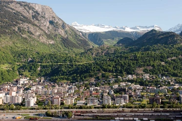
- Destination: Birgisch parking lot, 1093m
The Nesselloop leads in a trail style through alpine meadows, past blueberry fields, and along the Nessjeri Suone to the Nesselalp. It is worth taking a look into the Chapel Maria zum Schnee here and, of course, enjoying the panorama. The subsequent descent starts as a trail over rock slabs and roots. Up to the Chittumatte, the character of the route gradually changes and from here the trail becomes a rocky and dusty path. The route between Belalp and Birgisch requires advanced riding skills.

Good to know
Pavements
Best to visit
Directions
The route is marked with red signs. From the mountain station of the cable car, you reach the facilities of the gondola and the Kelchbach chairlift after a gentle descent on the gravel road. Following the red signs, you arrive at the Unner Staful on the Alpe Bäll. From there, you cross the bridge over the Kelchbach and thus reach the panoramic path to the Nesselalp. In the Nessel area, the path passes the idyllic chapel and goes down to Birgisch. The path to Birgisch is quite steep but manageable. From Oberbirgisch, there are various options to take different public roads towards Birgisch, Mund, Naters, or Brig.
Tour information
Cultural Interesting
Stop at an Inn
Equipment
Our recommendation: technically flawless bike, helmet, gloves and bell, clothing appropriate for the weather (always carry rain protection), drink and provisions.
Directions & Parking facilities
Arrival by car
From western Switzerland:
A9 Lausanne - Vevey, or northwestern Switzerland: A12 Bern - Vevey: A9 - Sierre: main road Sierre - Brig
From northwestern Switzerland:
A6 Bern - Thun - Spiez: main road Spiez - Kandersteg (car shuttle Lötschberg tunnel) - Goppenstein - Gampel - Brig
From eastern and central Switzerland:
Andermatt - Realp (year-round car shuttle Furka; in summer via Furka pass) - Oberwald - Brig
From Ticino (in summer):
Airolo - Nufenen pass - Ulrichen – Brig
Or via Centovalli – Domodossola – Simplon pass – Brig
From Italy (Aosta, Mt. Blanc Tunnel):
Aosta - Grand Saint Bernard Tunnel (in summer via the pass) - Martigny: motorway A9 - Sierre: main road Sierre – Brig
Or via Domodossola – Simplon pass – Brig
Blatten near Naters
From Brig you reach Blatten near Naters via Naters, then continue with the aerial cableway to the car-free Belalp.
Paid parking spaces are available in Chienzlichrommu and in the parking garage in Blatten near Naters.
More information can be found at:
Blatten-Belalp
Blatten near Naters is accessible from Brig or Naters by public transport.
You reach Belalp from Blatten by aerial cableway.
Birgisch
Take the post bus from Brig to Birgisch parking lot and start your route there.
You can find the timetable and further information about arrival at: www.belalp.ch
Additional information
If you have questions, please contact:
Belalp Bahnen AG
Blatten - Belalp Tourism AG
View this route on SchweizMobil:
Literature
The tourism office in Blatten provides you with information materials and brochures about mountain biking in the destination.
Author´s Tip / Recommendation of the author
Take a well-deserved break at Nesselalp with a fantastic view of the Great Aletsch Glacier and the Alpine panorama before starting the descent to Birgisch.
Safety guidelines
Use only the marked bike paths and roads and follow the signage. Please close gates and fences behind you. Be considerate of hikers as well as plants and animals. Hikers generally have the right of way. Assess your own skills and fitness well. Riding the different routes is always at your own risk.
Map
National maps Swisstopo 1:25,000: 2516 Aletsch area UNESCO World Natural Heritage
Nearby


