Rhein-Reuss-Rhône route: Salgesch - St. Léonard


- 4:56 h
- 17.19 km
- 326 m
- 403 m
- 506 m
- 704 m
- Difficulty: medium
- Start: Salgesch at the Johanniter hospice and Johannes church
- Destination: St. Léonard: town center
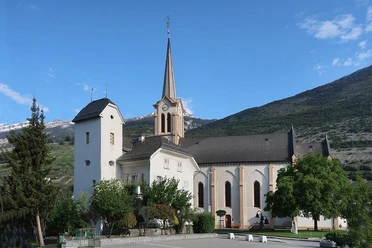
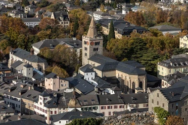
The medieval pilgrimage center Salgesch is the last German-speaking place on the language border. A huge landslide from the Varneralp 13,000 years ago covered the remnants of the former Rhône glacier and the remaining glacier transported the material to today's Sierre. On one of the remaining hills still stands the Gerunden monastery, whose first church was built in the 5th century. In the densely built town of Sierre, Christopher greets on the entrance facade of the former medieval parish church Notre-Dame-des-Marais. To the west of Sierre, we ascend into the vineyard slope. Behind the Château Villa — the epicenter of raclette and wine in Valais — we encounter the chapel St. Ginier, where a Christian sanctuary is said to have existed since the 7th century. We enjoy the path through the vineyard slope to St. Léonard, where at the back in the underground lake, an illuminated Virgin Mary awaits us.

Good to know
Pavements
- Unknown (1%)Street (57%)Trail (42%)
Best to visit
- suitableDepends on weather
Tour information
Culturally interesting
Refreshment stop
Additional information
- More information and links are included in the POIs (Points Of Interest).
Author´s Tip / Recommendation of the author
- We walk slightly elevated above the Rhône valley on the sunny slope. Every half hour we reach a bus stop, except for the last hour of the path, where there is no alternative to walking.
Safety guidelines
Path closure due to landslide on the stage Salgesch - St. Léonard:
Between St-Clément and St-Léonard: https://map.schweizmobil.ch/?detour=47&lang=de&bgLayer=pk&logo=yes&season=summer&layers=Wanderland&resolution=2&E=2600707&N=1123611