SALWALD - BÄTTCHRIZJI


- 3:15 h
- 7.06 km
- 577 m
- 575 m
- 1,597 m
- 2,174 m
- Difficulty: medium
- Start: Salwald
- Destination: Salwald
The hike starts at the Salwald restaurant above Mund. First, follow the usual hiking trail to the Hourmattewald. After a while, the path branches off into a smaller trail. Through the beautiful forest, the path steadily leads up to the Bättchrizji. The peace and view at this magical place are priceless and worth every drop of sweat. The descent leads via the Alpe Brischeru back to the starting point.
The path can also be started already in Mund. This extends the hike by about 2:15 hours.

Good to know
Pavements
Best to visit
Directions
The hike starts at the Safran restaurant above Mund. The path leads up through the Horumatten forest and is well signposted. At an altitude of about 2,000 m, you turn right off the main hiking trail. From here, the path is only marked with cairns and is sometimes not clearly visible. In some places, the path continues trail-less up to above the tree line. The Bättchrizji lies behind hollows and humps and is not easy to find. It is advisable to carry a map. Once arrived, you can recover from the exertion and enjoy the peace in this magical place.
The descent goes via the Alpe Brischeru back to the Salwald restaurant.
The hike can also be started from the village of Mund. This extends the hike by about 2 hours.
Tour information
Loop Road
Stop at an Inn
Equipment
Sturdy footwear, weather-appropriate clothing, sun and rain protection, as well as a sufficient supply of food and drinks are recommended in case there are no places to stop or shop open. The path is partly marked only with "cairns." For safety reasons, you should always carry a suitable hiking map. Poles can make hiking easier.
Directions & Parking facilities
Arrival by car
From Western Switzerland: A9 Lausanne - Vevey, or Northwestern Switzerland: A12 Bern - Vevey: A9 - Sierre: main road Sierre - Brig
From Northwestern Switzerland: A6 Bern - Thun - Spiez: main road Spiez - Kandersteg (Lötschberg tunnel car shuttle) - Goppenstein - Gampel - Brig
From Eastern and Central Switzerland: Andermatt - Realp (year-round Furka car shuttle; in summer via Furka pass) - Oberwald - Brig
From Ticino (in summer): Airolo - Nufenen pass - Ulrichen – Brig
Or via Centovalli – Domodossola – Simplon pass – Brig
From Italy (Aosta, Mt. Blanc Tunnel): Aosta - Grand Saint Bernard tunnel (in summer via the pass) - Martigny: highway A9 - Sierre: main road Sierre – Brig
Or via Domodossola – Simplon pass – Brig
Birgisch / Mund
From Brig you reach Birgisch and Mund via Naters.
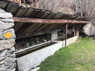
Parking is available at the Salwald restaurant or a bit higher up in Äbi.
Take the post bus to Mund village and start your route there.
Timetables and further travel information can be found at: www.sbb.ch
The Salwald restaurant can only be reached by car.
Additional information
For questions, please contact:
Belalp Bahnen AG
+41 (0)27 921 65 10
Blatten - Belalp Tourismus AG
+41 (0)27 921 60 40
Author´s Tip / Recommendation of the author
Enjoy a refreshment on the cozy terrace of the Salwald restaurant. Or how about a visit to the Safran Museum in Mund?
Safety guidelines
Despite the "infallible" marking of the hiking trails, we recommend always carrying a corresponding hiking map for safety reasons, so that, for example, in case of a thunderstorm or emergency, a safe area can be found quickly.
Especially in autumn, it should also be noted that fallen leaves on the ground can cover unevenness, roots, stones, or holes in the path. After storms, trees can still fall or branches fall off afterwards. Especially under adverse weather conditions, natural paths can become muddy and slippery in places. You must expect such path impairments when undertaking a hike.
Not all rocks or cliffs are secured with ropes or railings. Surefootedness is partly required. If you think certain path sections are impassable for you, you should avoid them.
Nearby
.jpg")


Download GPX file