- Photos & Map
How would you like to arrive?
- Description
- Good to know
- Nearby
Download GPX file
- 0:55 h
- 2.55 km
- 143 m
- 142 m
- 1,592 m
- 1,735 m
- 143 m
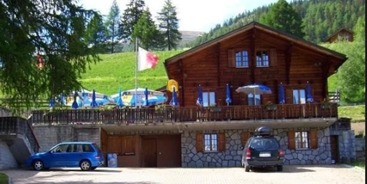
- Start: Salwald restaurant, Mund
- Destination: Salwald restaurant, Mund
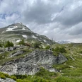
Start behind the Safran restaurant and follow the road north. After a short time, leave the road and turn left onto the hiking trail. Follow the path on a slight incline until it then descends again at the Sättli and leads down to the hamlet of Chastler. From there, the path leads along the Valais steppe and pine trail back to the starting point at the Salwald restaurant.
The path can also be walked well in the opposite direction.
Good to know
Pavements
Best to visit
Directions
Start behind the Safran restaurant and follow the road north. After a short time, leave the road and turn left onto the hiking trail. Follow the path on a slight incline until it then descends again at the Sättli and leads down to the hamlet of Chastler. From there, the path leads along the Valais steppe and pine trail back to the starting point at the Salwald restaurant.
The path can also be walked well in the opposite direction.
Tour information
Loop Road
Stop at an Inn
Equipment
Sturdy footwear, weather-appropriate clothing, sun and rain protection, as well as sufficient supplies of food and drinks are recommended in case there are no possibilities to stop for food or shopping or they are closed. Although the path is very well marked throughout, you should always carry a suitable hiking map for safety reasons.
Directions & Parking facilities
Arrival by car
From Western Switzerland: A9 Lausanne - Vevey, or Northwestern Switzerland: A12 Bern - Vevey: A9 - Sierre: Main road Sierre - Brig
From Northwestern Switzerland: A6 Bern - Thun - Spiez: Main road Spiez - Kandersteg (car shuttle Lötschberg tunnel) - Goppenstein - Gampel - Brig
From Eastern and Central Switzerland: Andermatt - Realp (year-round car shuttle Furka; in summer over Furka pass) - Oberwald - Brig
From Ticino (in summer): Airolo - Nufenen pass - Ulrichen – Brig
Or via Centovalli – Domodossola – Simplon pass – Brig
From Italy (Aosta, Mt. Blanc Tunnel): Aosta - Tunnel Grand Saint Bernard (in summer over the pass) - Martigny: Motorway A9 - Sierre: Main road Sierre – Brig
Or via Domodossola – Simplon pass – Brig
Parking spaces are available around the Salwald restaurant.
Additional information
If you have questions, contact:
Belalp Bahnen AG
www.belalp.ch
bahnen@belalp.ch
+41 (0)27 921 65 10
Blatten - Belalp Tourism AG
tourismus@belalp.ch
+41 (0)27 921 60 40
Author´s Tip / Recommendation of the author
Enjoy a refreshment at the Salwald restaurant.
Safety guidelines
Despite the "unmissable" marking of the hiking trails, we recommend always carrying an appropriate hiking map for safety reasons, so that you can quickly find a safe area, for example, in case of a thunderstorm or emergency.
Especially in autumn, care must also be taken that the fallen leaves on the ground can conceal unevenness, roots, stones, or holes in the path. After storms, there may still be falling trees or branches. Especially in adverse weather conditions, nature trails can have muddy and slippery sections. You must expect these kinds of path impairments when you go hiking.
Nearby
