


- 2:05 h
- 6.45 km
- 232 m
- 232 m
- 675 m
- 907 m
- 232 m
- Start: Naters, Marktplatz (676 m)
- Destination: Naters, Marktplatz
The relatively new suspension bridge between Naters and Bitsch is only around 40 metres long, but offers an impressive view of the Massa Gorge.
This bridge opens up a connection that is particularly popular between spring and autumn.
The suspension bridge is right on the doorstep, so to speak, as it can be reached on a short hike from Naters via Hegdorn.
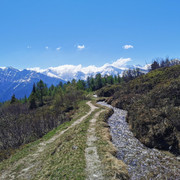
The way back leads along the popular Rote Meile, the former railway line of the FO-train, which has been converted into a promenade. Alternatively, you can also take the path along the river Rhone.

Good to know
Pavements
Best to visit
Directions
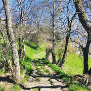
Start from Naters via Klosi in the direction of Hegdorn. From there, continue to the suspension bridge. The trail is not easy to find, but it is well signposted. The trail starts at the hamlet of "Hegdorn" and leads you down towards the Massaschlucht gorge. From the suspension bridge, you reach the bottom of the valley at Bitsch in ten minutes. From there you continue along the popular Red Mile promenade back to Naters.
Naters - Hegdorn - suspension bridge - Bitsch - Naters
Tour information
Familiy-Friendly
Loop Road
Stop at an Inn
Equipment
Directions & Parking facilities
From western Switzerland: A9 Lausanne - Vevey, or north-western Switzerland: A12 Bern - Vevey: A9 - Sierre: main road Sierre - Brig
From north-western Switzerland: A6 Berne - Thun - Spiez: main road Spiez - Kandersteg (Lötschberg tunnel car transport) - Goppenstein - Gampel - Brig
From eastern and central Switzerland: Andermatt - Realp (year-round Furka car transport; in summer via Furka Pass) - Oberwald - Brig
From Ticino (in summer): Airolo - Nufenenpass - Ulrichen - Brig
Or via Centovalli - Domodossola - Simplonpass - Brig
From Italy (Aosta, Mt. Blanc Tunnel): Aosta - Grand Saint Bernard tunnel (over the pass in summer) - Martigny: A9 motorway - Sierre: Sierre - Brig main road.
Or via Domodossola - Simplon Pass - Brig
Hegdorn
From Brig you can reach Hegdorn via Naters
You can find more info at:
You can find the SBB timetable at: www.sbb.ch
Additional information
If you have any questions, please contact:
Belalp Bahnen AG
Blatten - Belalp Tourismus AG
Author´s Tip / Recommendation of the author
Enjoy a coffee at the Bistro CappuGiro in Bitsch.
You can finish off in Naters at the Cafe Zuckerpuppe with local products.
Safety guidelines
Despite the "untraceable" marking of the hiking trails, we recommend for safety reasons to always have an appropriate hiking map with you, so that you can quickly find your way to a safe area in case of a thunderstorm or emergency, for example.
Especially in autumn, you should also be aware that leaves lying on the ground can hide bumps, roots, stones or holes in the path. After storms, trees can still fall over or branches can fall down. Especially in adverse weather conditions, muddy and slippery passages can occur on natural paths. You have to expect this kind of path impairment when you go on a hike.
Not all rocks or precipices are secured with ropes or railings. In some cases surefootedness is required. If you are of the opinion that certain sections of the trail are not passable for you, you should avoid them.
Nearby


