- 2:45 h
- 8.65 km
- 196 m
- 355 m
- 1,174 m
- 1,446 m
- Difficulty: medium
- Start: Blatten bei Naters, valley station (1332 m)
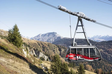
- Destination: Ried-Mörel village - gondola
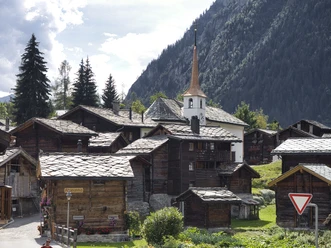
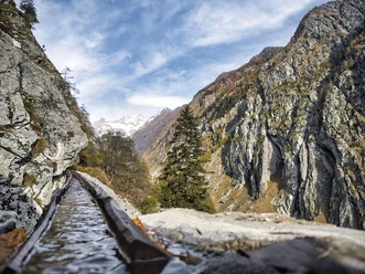
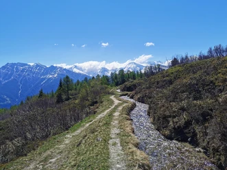
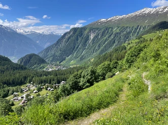
The Massaweg leads you from Blatten bei Naters via the Blattnerschliecht forest to Gragg and from here along the former Suone Riederi, first mentioned in 1385, to Ried-Mörel. The steepest rock face around which, until the end of the 1930s, six long channels led at dizzying heights is now bypassed by a short tunnel. Enjoy the beautiful view of the Rhone Valley and the Valais Alps here.

Pavements
- Street (4%)Asphalt (8%)Trail (14%)Path (74%)
Best to visit
- suitableDepends on weather
Directions
- In Blatten bei Naters, you cross the village and hike through the Blattnerschliecht to the Gibidum bridge and follow the Massaweg signage. Via Gragg, you reach the Suone Riederi and follow its route along a blasted, airy path above the impressive Massa gorge. After about 3 hours, you reach Ried-Mörel. Here you can take the gondola to Mörel. In Mörel, you cross the main road and take the Matterhorn Gotthard Railway to Brig.
On the Massaweg, you have the option to leave the trail earlier. For example, you can leave the path at Ebnet and walk to Bitsch. From Bitsch, you can walk the Rote Meile through Naters towards Brig.
Blatten bei Naters - Massa - Gragg - Steischlag - Schwarzes-Flesch - Rischwald - Roti Flue - Ried-Mörel
Tour information
Culturally interesting
Refreshment stop
Equipment
- Sturdy footwear, weather-appropriate clothing, sun and rain protection, as well as sufficient supplies of food and drink are recommended, should no inns or shops be available or open. Although the path is very well marked throughout, for safety reasons you should always carry a suitable hiking map. Bring poles or other aids.
Directions & Parking facilities
- Getting there
Arrival by car
From Western Switzerland: A9 Lausanne - Vevey, or Northwestern Switzerland: A12 Bern - Vevey: A9 - Sierre: Main Road Sierre - Brig
From Northwestern Switzerland: A6 Bern - Thun - Spiez: Main Road Spiez - Kandersteg (car shuttle Lötschberg tunnel) - Goppenstein - Gampel - Brig
From Eastern and Central Switzerland: Andermatt - Realp (year-round car shuttle Furka; in summer via Furka pass) - Oberwald - Brig
From Ticino (in summer): Airolo - Nufenen Pass - Ulrichen – Brig
Or via Centovalli – Domodossola – Simplon Pass – Brig
From Italy (Aosta, Mt. Blanc Tunnel): Aosta - Grand Saint Bernard Tunnel (in summer via the pass) - Martigny: Motorway A9 - Sierre: Main Road Sierre – Brig
Or via Domodossola – Simplon Pass – Brig
Blatten bei Naters
From Brig, you reach Blatten bei Naters via Naters.
ParkingPaid parking spaces are available at Chienzlichrommu and in the parking garage in Blatten bei Naters.
Further information can be found at:
Public transportationBlatten bei Naters is accessible by public transport from Brig or Naters.
Timetables and further travel information can be found at: www.belalp.ch
Additional information
- If you have any questions, please contact:
Belalp Bahnen AG
Blatten - Belalp Tourismus AG
Author´s Tip / Recommendation of the author
- Along the path, there are several information boards on the theme "Water connects." For example, you learn that similar methods are used in Nepal to transport water along slopes to fields. The boards explain the similarities of the two traditions and provide insights into customs and myths surrounding this tradition.
Safety guidelines
- Despite the "unmistakable" marking of the hiking trails, for safety reasons we always recommend carrying an appropriate hiking map so that, for example, in case of thunderstorm or emergency, you can quickly find a safe area.
Especially in autumn, attention must be paid to the ground leaves that can cover unevenness, roots, stones or holes in the path. Trees can still fall or branches fall after storms. Particularly in adverse weather conditions, natural paths can have muddy and slippery sections. You must expect such path impairments when undertaking a hike.
Not all rocks or cliffs are secured with ropes or railings. Surefootedness is partly required. If you consider certain sections of the path impassable, you should avoid them.